|
Trails and Maps
|
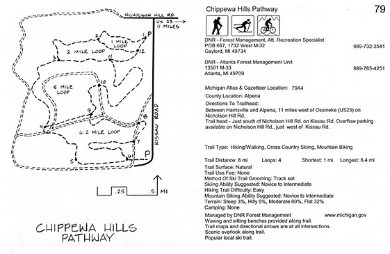
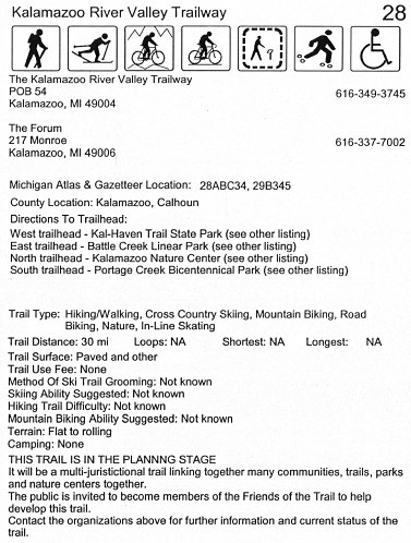
Every trail entry includes quick
recognition symbols at the top of each page to
easily identify the permitted uses of the trail.
Included in the trail entry are at least one map
(often more), addresses, phone no's, web sites,
trail head directions, complete trail
descriptions, difficulty ratings, general trail
information and much more.
|
Click Here
For Addition Map Samples
|
For quick reference, at the top of each
text page are symbols representing each
activity. From left to right are Hiking, Cross
country skiing, Mountain Biking, Road Biking,
Nature trail, In-line skating and Barrier free
trail. Also note that this trail is proposed.
Throughout the Atlas there are trails that are
in various stage planning and development.
|
|
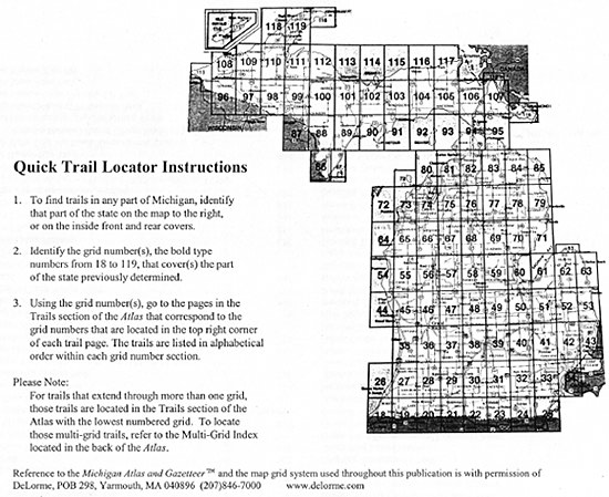
The Atlas uses the DeLorme grid system
to quickly find trails in any part of the state.
The bold number in the top right comer of the
text portion of the page is also one of the grid
numbers shown on the map above.
|
|
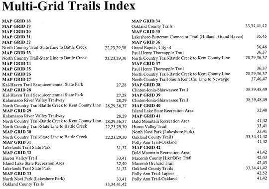
New with this edition there is a
Multi-Grid Index. For trails that pass through
more than one grid, the trail is located in the
Atlas in the section with the lowest number. For
those who wish to find trails in a specific part
of the state, this index will assist in finding
trails that are located in a section of the
Atlas with a lower grid number but pass through
a grid with a higher number.
|
Click Here
For Addition Map Samples
|
The undisputed non-motorized trail
authority for Michigan since 1977. The author's
25th anniversary of writing guides for
Michigan's non-motorized trail network.
The Trail Atlas of Michigan is sold in bookstores, bike shops and outdoor stores throughout Michigan.
|